What is aerial survey?
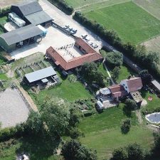
An aerial survey is survey that is carried out using a drone. This can be taken from up to 400ft depending on how much area you are surveying. This is probably one of the easiest ways to get the information you need that will be recorded and can be used time and time again.
Aerial photographs can be taken and then put together at a later date to make a three-dimensional model of the land that is being surveyed.
The advantage to this process is that you do not physically have to walk round taking pictures yourself. There will be areas that you will never get to, let alone see, so hiring a professional company like Drone Missions to carry out this service will only benefit you.
